Crazy Carl's Western China KMZ
1) What's Google Earth 3D (GE)?
3) What's in CC'sWestern China KMZ file?
|
Crazy Carl's Western China KMZ 1) What's Google Earth 3D (GE)? 3) What's in CC'sWestern China KMZ file? |
|
1) What's Google Earth 3D (GE)?Google Earth 3D (GE) must be one of the greatest applications to arrive on the Internet in recent years. Essentially, GE is a scalable manipulable 3D model of the Earth which uses satellite and other imagery as a base map. Other parties can supplement this base map with anything from personal images to high-resolution photos from air-craft. In addition to photos, GE supports "layers" (information placed on top of the base map) which uses exact coordinates or general regions to share other types of information like real-time cloud cover data, interesting articles or even a complete Mars! |
2) What's a KMZ/KML file?KMZ/KML files (*.kmz) are what GE uses to store and trade place marks, layers and any other information overlayed on the 3D globe. These files are usually very small and transfer very quickly yet allow access to an incredible amount of information. Although creating and working with KMZ files is still a little clumsy, with some time and patience you can assemble your own comprehensive 3D world of the places you've been and traveled.
|
3) What's in CC's Western China KMZ file? |
|
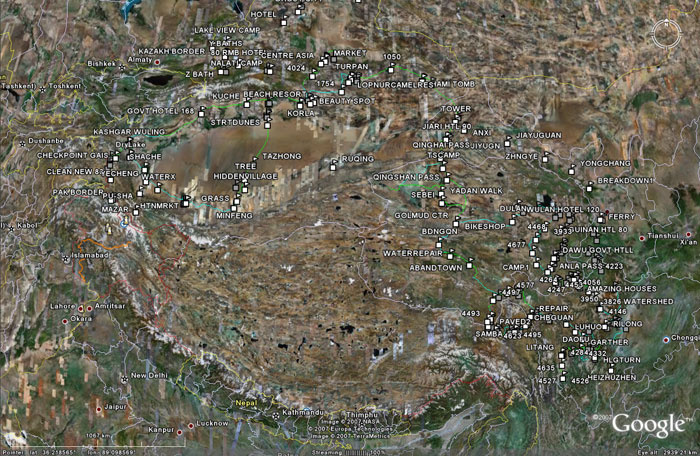
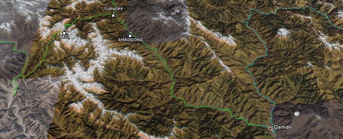
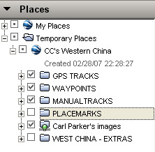
CC's Western China KMZ file contains: - GPS tracks and manually created paths - One problem with using GE is it's lack of accurate roads in China. If you're planning to explore Western China, now some of that problem is solved! - GPS waypoints and placemarks - GE's listing of cities in remote China leaves a little to be desired. Included is hundreds of useful waypoints and placemarks which include:
|
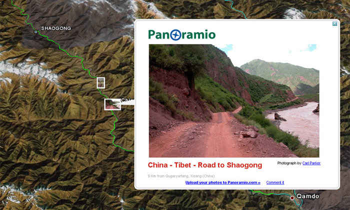
- Panoramio KML - Panoramio is a free service which allows users to download photographs, assign coordinates to those photos (called geotagging) and then browse images according to location. While it has it's own web interface (mentioned below), Panoramio will also generate an automatically updating KML file which, as a layer, is imported to the Western China KMZ. - West China Extras - A collection of other KMZ's which include detailed city and geographic information of Qinghai, Xinjiang and the Karakoram Highway. Finally, you can view tracks, waypoints and images of exact places all in one file! Note: GPS way points were also acquired with the help of a good friend, C. Poynton, who's extensive road travels of China provide you with more information than my trips alone. |
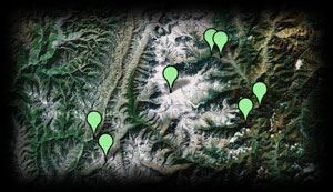
Viewing Tracks and Way Points Only
Green tracks are GPS data. Blue tracks are hand drawn. |
|
Viewing Tracks, Way Points and Images
|
|
4) How do I use the Western China KMZ file? |
|
- First, if you don't have it already, download Google Earth 3D using the link below.
|
- Second, familiarize yourself with browsing (called "flying") around GE. - Please keep in mind the amount of data being download to your computer when using GE. It may run a little slow depending on your computer and graphics card. |
|
- Third, download CC's Western China KMZ file and open it using GE.
|
5) Can I see the images and map without using GE? |
|
Yes. Panoramio has it's own web based interface which uses Google Earth's base maps and the same coordinate data. This information will not be the exact same. Although the map is mouse browsable, Panoramio gives only images and locations. It lacks track data and way points. With over one million images in it database, it's a good place to start looking for other images as well. |
Click below for Panoramio
|
I'd like to add that this KML file is neither perfect or static. If you should find incorrect information in it please notify me for correction. Also, as I travel to new places the file will be updated. Finally, I hope you will find some of this information useful for your trip planning. Please contact me with any questions or comments. |
|
 |